Quick links to other parts of this page:
- I wrote a book! With a graduate school colleague as lead author, we wrote (and photographed, and illustrated) a new, updated guide to the geology of the Pacific Northwest- Rocks, Minerals, and Geology of the Pacific Northwest, published by Timber Press in March 2021. Click for more information!
- “Science in 10” YouTube channel. Started during the Covid-19 pandemic to supplement online classes, adding more short instructional videos as time allows. Click for more information and links to the individual videos!
- #FunFactFriday blog, with lots of cool information about the geology of the Washington and the Pacific Northwest. Disclaimer- published on Fridays, but not every Friday!
- Click HERE to access a tutorial I wrote for creating a geologic map using ArcGIS, an essential skill in the geosciences! (Opens in a new tab)
- Samples of geologic illustrations, figures, and maps
- Click HERE to view my full curriculum vitae
Why the need to communicate Geology?
Everything that we do in our daily lives, from making coffee in the morning to commuting to hiking- depends on some aspect of the Earth sciences. These disciplines (geology, oceanography, geomorphology, atmospheric science, etc.) are relevant to all of us, and I strongly feel that we should have a base understanding of how our Earth system works. Here’s a great example: I assembled the the image below as a composite of different types of data available from the National Oceanic and Atmospheric Administration (NOAA) and the US Geological Survey Earthquakes Hazard Program (USGS), showing hazards and events taking place in North America during the first week of September 2017. Click here for a larger version of this image. (opens in a new tab)
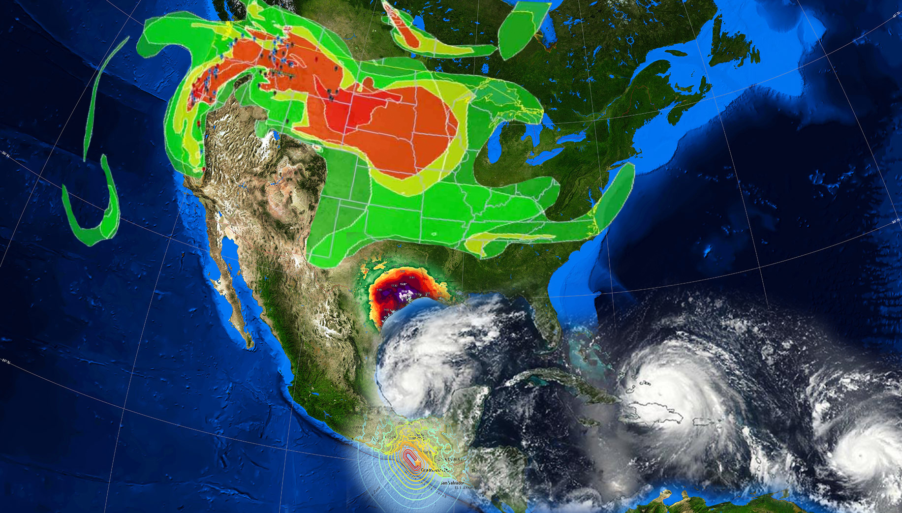
What’s all on the image? Let’s walk through the data.
(1) Fires in the western states and smoke/ air quality across the continent (Light green- light to red- heavy smoke)
(2) Precipitation in Texas as a result of Hurricane Harvey (Purple to white areas received more than 15-20″ of rain, as much as 40+” during a single event)
(3) A Magnitude 8.1 earthquake in southern Mexico in the late hours of 8 September, contours show intensity of shaking
(4) THREE concurrent hurricanes in the Caribbean/ Gulf of Mexico- Katia, Irma, and Jose (left to right)
While these are examples of what might be termed Natural Disasters of Hazards, by understanding how and why these events form and occur we as a society can properly prepare for consequences and mitigation. This is why I teach- doing my small part to help all of us understand how our planet works and the impacts it has on us, and the impacts we have on the planet.
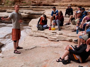
- Teaching about debris-flow incisional processes in the ultimate classroom- the Grand Canyon of the Colorado!
