#FunFactFriday – Land of Fire and Ice (Part 2- Into the core of a mountain range!)

With very (very!) broad definitions, rocks come in 2 main types: Crystalline (composed of interlocking crystals of one or more minerals); and clastic (composed of pieces of other rocks that have been cemented together). And different types of rocks can broadly be explained and classified by the Rock Cycle.
Liquid rock (magma in Earth’s interior, lava on the surface) cools and crystallizes to form igneous rocks; rocks at the surface break down into smaller rocks and can become cemented together to form sedimentary rocks; and rocks in Earth’s crust can be subject to intense pressures and temperatures which produces a change in mineral composition and forms metamorphic rocks!
However- it’s very easy to interpret the rock cycle that we tend to learn as 3 distinct types of rock, and not focus on the in-betweens. In reality, the rock cycle is more of a continuum. For example, when rocks melt to form magma it is a long process with many different stages. Each different mineral has a different melting temperature, so as a body of rock heats up different minerals will melt at different times producing a mush of liquid and solid rock- a process called “partial melting.” And the same process works in reverse! As magma cools different minerals will crystallize from the melt at different times, again producing a mush that is part igneous rock and part magma.
It’s actually some of these in-between rocks that can tell us a huge amount about a region’s geologic past!
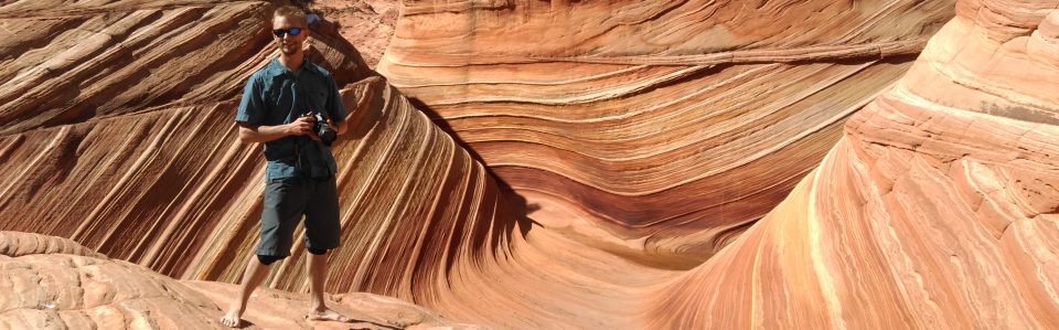
Take for instance, the Thunder Knob trail just off of Highway 20 in the North Cascades. We’re still in the Crystalline Core of the mountain range- igneous and metamorphic rocks that formed in the Cretaceous period deep below an ancient mountain range similar to the modern Cascades. Definitely look down at your feet for parts of this hike!
These rocks are banded gneiss, a high-grade (very thoroughly altered) metamorphic rock characterized by wavy bands of light- and dark- colored minerals. To get an idea of the intense environment where these rocks formed, consider that the original location of these rocks were over 20 kilometers deep within the crust! So intense, that the temperatures there were high enough to start melting some of the minerals in the rock.
But not enough to melt the entire rock!
This particular type of partially-melted metamorphic rock is named a migmatite. Many of the lighter-colored mineral bands in the rock melted during its formation, then cooled in place. With some bigger exposures of this rock (the one across the highway from the Diablo Lake overlook is one of my favorites!), one can notice these swirly bands of light colored minerals, almost as if the rock had once been in a giant, heated blender!
Also something specific to the gneiss and migmatite around Diablo and Gorge Lakes, many portions of it are garnet-bearing….. so if you’re a fan of small, shiny, dark red garnets this is a great location to look for them! Not gemstone quality, but pretty nonetheless 🙂
#FunFactFriday – Land of Fire and Ice (Part 2)

And back to another classic Washington locale- the North Cascades as viewed from the top of Maple Pass!
Geologically, the North Cascades are divided up into three provinces, or domains (depending on which term you’d rather use). The Western Domain (west of Marblemount) is a mix of accreted rocks, primarily sedimentary and metamorphosed sedimentary and volcanic rocks that were originally part of or on top of the ocean floor during the Mesozoic, about 250- 80 million years ago before being added to the North American continent.
The Central Domain, or Crystalline Core, is a beautiful set of igneous and metamorphic rocks that are a representation of the deep and sometimes tumultuous core of a vast mountain range. A mountain range similar to the southern Cascades today, but that formed around 200- 100 million years ago and a couple thousand kilometers to the south! (Likely, this is the Baja-BC Hypothesis and the “tropical” origin of some of the rocks, Mount Stuart is a great example that we’ve talked about before!)
East of the Crystalline Core is the Methow Domain, mainly Cretaceous (~140- 80 million year old) rocks of an ocean basin and the sediments deposited in that basin. Though, unlike the Western Domain and Crystalline Core, much of the Methow Domain is surprisingly not metamorphosed… but quite deformed nonetheless.
Separating these three domains are large crustal-scale faults, some with a very significant component of vertical offset between rocks on either side. And it’s this vertical offset that allows us to peer into the deep core of a mountain range!
Volcanic mountain ranges like the Cascades form when a piece of the oceanic crust is colliding with a piece of continental crust. Since the oceanic crust is slightly denser, it is shoved underneath the continent in a process of subduction. This process also generates magma, which works its way up through the continent and forms the volcanoes that we are so familiar with in the Pacific Northwest.
But what’s going on really deep within the continent? Well, a few things! Magma that doesn’t work its way to the surface can cool and crystallize, forming large bodies of granitic-adjacent* composition rocks known as batholiths (*I’ll have to do a post later on all the varieties of “granite”). Rocks that were already present in the continent are squeezed by the collision and forced downward due to the thickening of the crust. These rocks and parts of the batholiths are subject to pretty intense pressures and temperatures in the lower parts of the crust, and will experience varying degrees of metamorphism- depending on how deep the rocks got! This process typically forms different types of gneiss, a high-grade metamorphic rock readily identified by parallel or wavy banding of light- and dark-colored minerals.
And later on, geologically speaking, if these rocks are uplifted along faults and eroded by glaciers (hey, like in the North Cascades!) then we get to observe this history of melt, crystallization, and intense metamorphism that was taking place over 20 kilometers below the surface!
Looking southwest from Maple Pass, one is staring into the Crystalline Core of the North Cascades. Many of the jagged, glaciated peaks in the background are varieties of gneiss and other rocks that formed deep within the crust. And for good measure, there’s also Glacier Peak- one of the modern Cascades volcanoes! Fun to think that the processes that initially formed the Crystalline Core of the North Cascades millions of years ago are still going on today! Bet if you dug 20 or so kilometers down you’d find a pretty geologically violent environment, with enough pressure and heat to partially melt and deform rocks…
And it’s this “violent” environment that’s likely the next topic, along with one of my personal favorite rocks that forms there- migmatite!
#FunFactFriday- Land of Fire and Ice (Part 1)

Apologies (ish, not really) for the kind-of Game of Thrones reference, but it just works so well! Many of the iconic landscapes in Washington were formed by fire (e.g. volcanoes and other processes associated with molten rock), and then shaped by ice- in the form of glaciers!
Glaciers are essentially giant masses of ice that form in high altitude or high latitude regions where yearly snowfall in the winter exceeds snowmelt in the summer. As the snow collects year-round, additional layers of snow will compress the snow underneath into glacial ice. And soon (geologically speaking), the newly formed glacier will have enough mass to begin flowing downslope!
As the glacier flows downslope, the mass of ice does an incredible amount of work on the landscape. Those giant, deep valleys of the North Cascades? Carved by glaciers! Those high, pointy peaks in the Olympic Mountains? Glaciers! Most of the landscape in the Enchantments? You guessed it- glaicers!
But it’s not only the really big features that glaciers leave behind once the ice melts, there are many other smaller features that you can use to determine if a location was once occupied by a glacier.
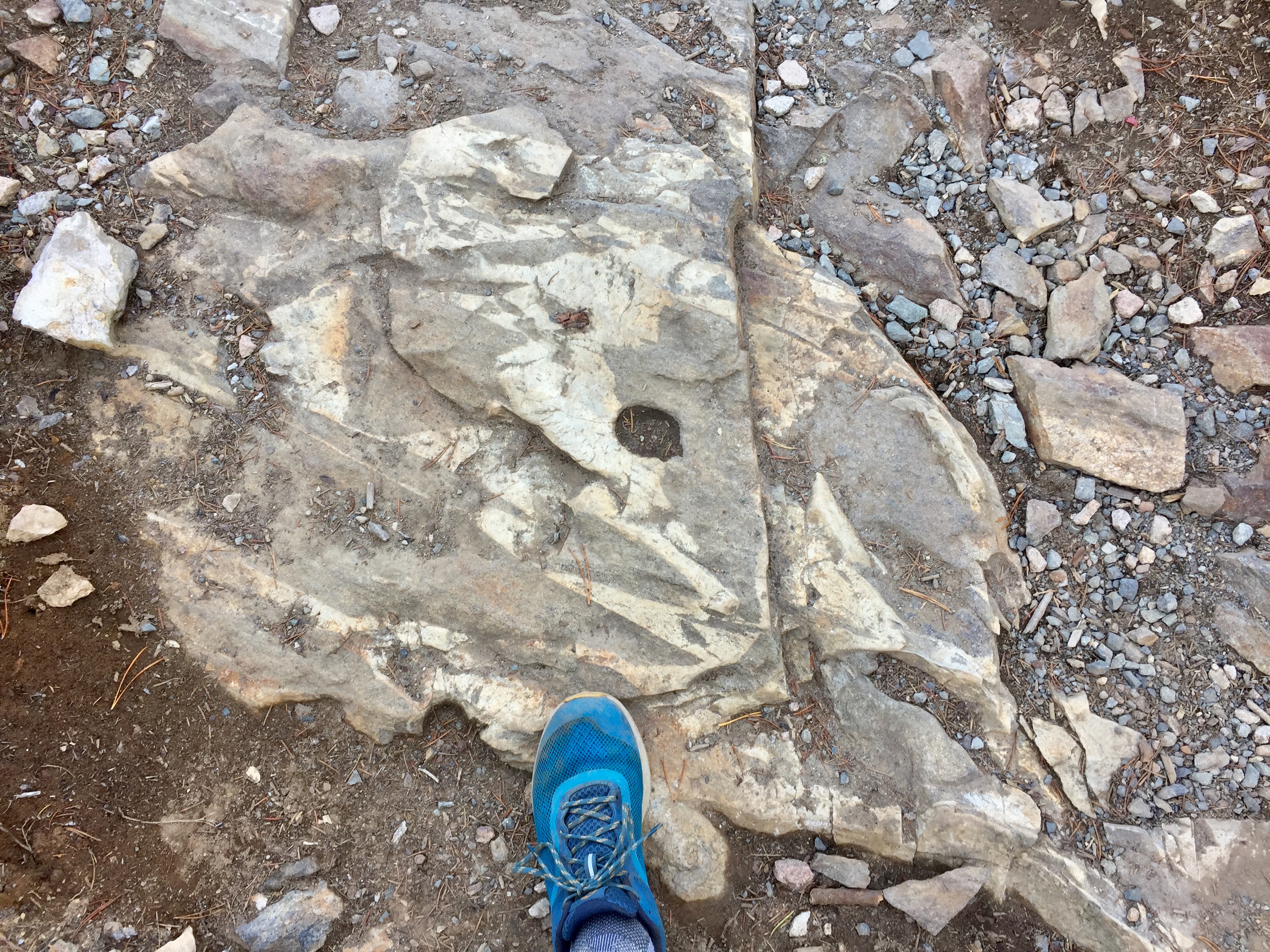
A lot of the erosional work done by glaciers comes from rocks that become frozen at the base (bottom) of the ice. These rocks range in size from tiny sand particles all the way up to house-size boulders. The rocks are also angular and jagged in shape, and as the glacier moves these rocks scrape and grind away at the bedrock the glacier is flowing over. Imagine taking a piece of very coarse-grit sandpaper, and running it over a block of wood. What’s left behind? Lots of scratches in the direction that you moved the sandpaper!
The exact same thing happens with glaciers. Rocks frozen into the base of a glacier will scrape the bedrock underneath, leaving behind scratches- or striations- that we use today to identify locations where glaciers were, and what direction the glacier was flowing in!
This photo is an outcrop along the trail to Inter Glacier and Camp Schurman on the White River side of Mt. Rainier. The remnants of Inter Glacier proper are in the background, but the darker rock in the foreground is covered in glacial striations! You can also notice that the rock is pretty smooth and polished, aside from the striations. Larger rocks in the base of a glacier will leave behind the deeper scratches, while smaller ones will act as finer and finer grit “sandpaper” and polish the rock smooth.
So if you’re ever wondering or wanting more evidence that where you are hiking was once covered by a glacier, check out what you’re walking on! Striations and polish are pretty straightforward to identify, and always a fun find. 🙂
#FunFactFriday- Come Visit Exotic Washington! (Part 3)

Ah, the San Juan Islands. And just like much of the Pacific Northwest, the rocks that form the San Juans are exotic! Again, we as geologists use the term “exotic” to describe rocks that formed somewhere else on the planet, and then were transported to their current location by various plate tectonic processes. A great general example of this would be rocks that form on the ocean floor (on top of an oceanic tectonic plate), then get transported along the oceanic plate to a subduction zone- a massive collision with a continent. Here, the oceanic plate will be shoved underneath the continent because of its greater density… but rocks on top will be scraped off and accreted/ added to the continent.
Most of the San Juan Islands are composed of rocks that were once part of the ocean floor, or ancient island arc volcanoes (similar to the Aleutian Islands or Japan today). These rocks formed during the Jurassic and Cretaceous periods (~200- 150 million years ago, give or take a couple weeks), and then were added to North America around 90- 100 million years ago. But there’s a little more to these rocks than just what’s at the surface, and what we hike around on or take the ferries past… a much deeper story…
The interior of the Earth is structured into many different layers- one specific way to classify these layers is roughly based on their composition. During the early formation of our planet, while it was still mostly molten, heavier elements like iron and nickel sank to the center, forming the core. Slightly less dense iron and magnesium-rich minerals formed a large mantle surrounding the core, and the lightest or lower-density minerals (those that contain lots of silicon, oxygen, potassium, aluminum, calcium) “floated” to the surface and formed the crust. Of course, over time the crust solidified and then things* happened and we have the Earth today!
(*LOTS of the things…)
But wait a minute. How can we know the composition of the Earth’s mantle? We as humans have never been able to drill deep enough to actually sample the mantle! How do we observe such a thing?
It turns out that there are ways to indirectly sample the Earth’s mantle. Some volcanoes with very deep magma sources will bring up small pieces of the mantle during eruptions. In other places sections of the very base of the ocean crust, which contains material from the upper-most mantle, can get caught up in the accretion of exotic rocks to a continent!
Which brings us to the photo! 🙂
You might think that Green Point along the loop trail in Washington Park, Anacortes, is named for the trees, but I’d guess it’s named for the rocks! The rocks here are peridotite, similar in composition to the rocks on the way to Lake Ingalls, but these particular ones formed much deeper in the Earth. The brownish-orange color of the rocks is a result of weathering, oxidation and alteration of the minerals in response to being exposed to Earth’s atmosphere. But if you poke around the outcrop, you’ll find fresh rock faces where the color is a very dark, shiny green. These iron and magnesium-rich rocks are part of the upper mantle (think like 15- 20 km deep!), transported to the surface when they and the oceanic crust above got squeezed upwards during the accretion process, as the package of rocks that is now the San Juan Islands was being added to North America. And now we can hike around on the Earth’s interior!
So I guess that for the bigger-picture moral of the story, we could say that the Earth’s mantle is….
Green!
Side note, this is one of my favorite pictures of my old dog Skykomish. He was my field partner for grad school research, hiking partner, skiing partner, and all-around best adventure dog. Probably hiked thousands of miles with this guy, and he never complained once. Sadly he had to cross the rainbow bridge in 2021, but I know he’s somewhere romping around with that goofy smile.
#FunFactFriday- Come Visit Exotic Washington! (Part 2)
Starting today’s post with a quick review, or introduction if you’re just joining in, the majority of rocks that make up Washington (and the greater Pacific Northwest) are exotic- meaning the rocks formed somewhere else on the planet and were transported here and added to North America through plate tectonic processes. The exotic rocks in Washington are grouped together into different terranes, delineated by similar rock types, ages, and where the rocks initially formed. Different types of terranes that were added to North America during the formation of the Pacific Northwest between ~250- 50 million years ago include volcanic island arcs (think the modern-day islands of Japan), small micro-continents (modern-day Madagascar or the island of New Guinea), or just large sections of the ocean floor.
The final major terrane to be added to the Pacific Northwest is a large group of volcanic rocks, an undersea volcanic plateau if you will, that were accreted around 50 million years ago to essentially form our modern coastline. It’s important to keep in mind here- this age of 50 million years is when the rocks were added to North America, their actual formation was around 7 million years earlier. These volcanic rocks are quite extensive, outcrops of them are present from Vancouver Island in the north to the Oregon Coast Range near the town of Roseburg in the south.
This is the terrane of Siletzia, which formed from voluminous eruptions of basaltic lava on the ocean floor. The exact mechanism is still debated, but likely either seamounts like the Hawaiian Islands, a region of intense volcanic activity similar to Iceland, or maybe it formed a little closer to the continental margin! Either way, the lavas that form a lot of Siletzia were erupted underwater.
Underwater? How do we know?
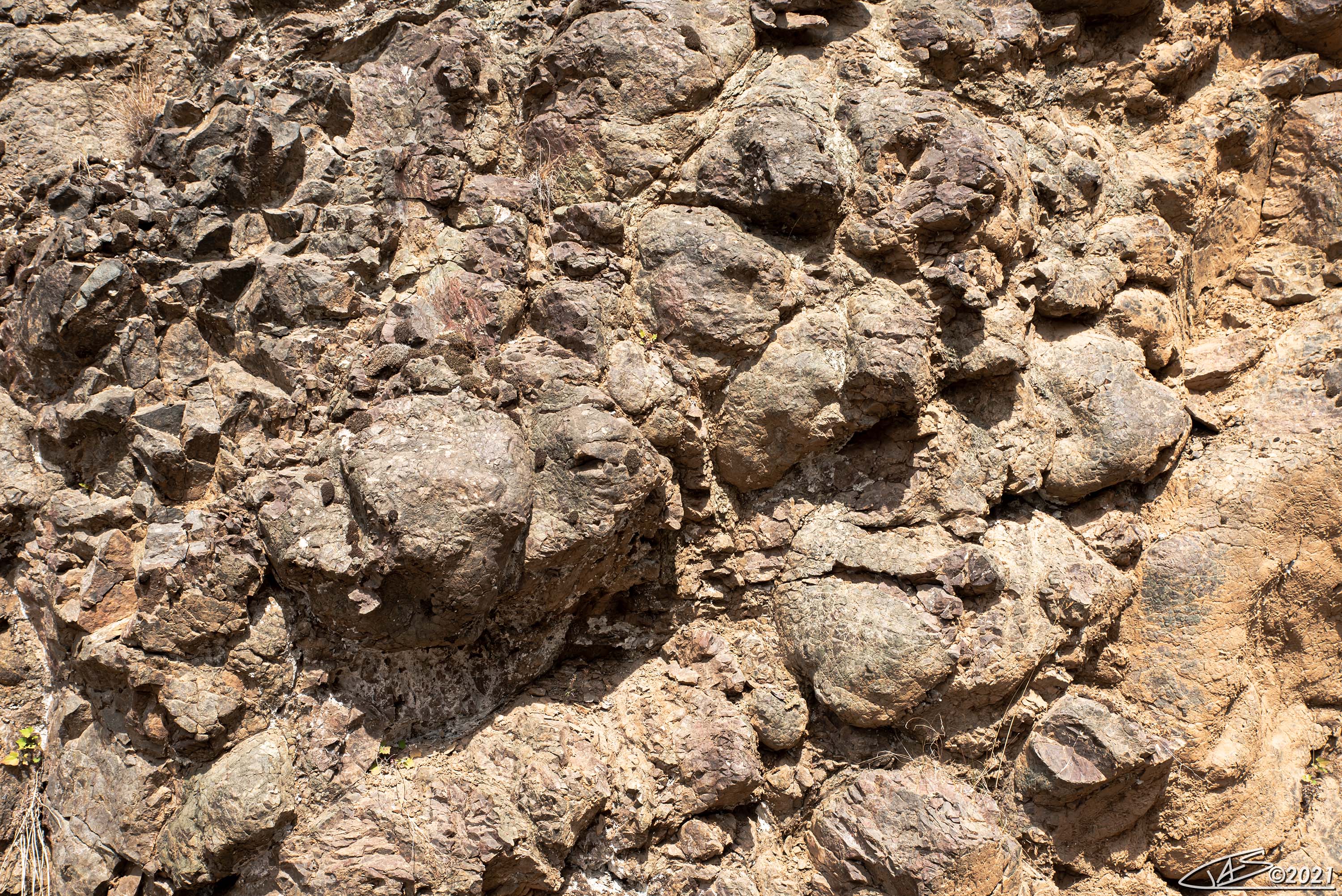
And here’s where the photo comes in! While it not look as impressive as a giant granitic mountain wonderland like the Enchantments, the rocks here still tell a great story! This is a photo of a small part of Siletzia a short hike from the Hurricane Ridge Visitor Center in Olympic National Park. For scale, the photo is about 3 meters/ 9ish feet across.
The exact rocks here are pillow basalts- the same general flavor as the ubiquitous Columbia River Flood Basalts of eastern Washington, but quite a bit older and also exotic!
Magma/ lava with a basaltic composition has a very low viscosity, it’s about as runny or fluid as molten rock can get. When these really “runny” lavas erupt on the ocean floor, the outside of the flow will cool/ crystallize/ harden into rock almost instantaneously when in contact with the cold ocean water. We call this process “quenching”, and it also insulates the interior of the lava flow! The lava keeps erupting, and breaks out into smaller round-ish lobes. As more and more lava erupts, more and more of these lobes form and pile up on top of each other.
If this pile of lobes is then uplifted into a mountain range, the Olympics for example, erosion will expose these lobes… and will end up looking like a stack of round pillows!
Each one of the round-ish “blobs” in this photo is an individual pillow, and this distinct morphology of the lava lets us know that it formed underwater, despite being at over 5000 ft elevation today! Fun features that are relatively straightforward to identify when on the trail or from you car window J
Think we’ll continue with “Exotic Washington” next week, but it will be a much deeper post…
#FunFactFriday- Come Visit Exotic Washington! (Part 1)

Really, in my professional opinion (as a geologist), the best way to explore a region’s geology is hiking. Whether it’s backpacking for 3-5 days across multiple alpine passes, or hiking 10 meters from your car to a roadcut (or even just experiencing the roadcuts from your car!), every rock or group of rocks has a cool story to tell.
Aside from a few isolated outcrops in eastern Washington, the bulk of our state is *exotic*- a term we use to describe rocks that were formed in some other location on the planet, then transported to their current location via tectonic plate motion and accretion. Large related groups of exotic rocks (similar rock type and age) are referred to as “exotic terranes”. Imagine having a bunch of strips of different-colored Play-Doh laid out on a table in front of you, then sliding and smashing them all together to form a larger blob. This is analogous to to a large part of Washington’s geologic history, where rocks that formed elsewhere were transported here through colliding* tectonic plates!
(*mostly…. of course there’s still some debate on parts, but we’ll get to that!)
Last week we checked out some rocks that formed in a deep ocean basin around 450 million years ago (Ma), this basin being produced by the breaking apart of the old supercontinent Rodinia. This ocean basin didn’t exist forever, and around 250 Ma the plate tectonic setting changed and the ocean floor (and all the rocks on top of it) began to be pushed back towards the land mass that would eventually become the North American continent.
When a section of the ocean crust collides with a continent, since the rocks of the ocean crust are slightly denser than the continent it will be shoved underneath in a process of subduction. But not all of the ocean crust is subducted, the continent can act as a giant, tectonic-scale bulldozer and scrape off rocks that were deposited on the ocean floor, volcanic islands that get caught up in the process, smaller micro-continents, and even pieces of the deep ocean crust itself! As these rocks are bulldozed off of the ocean crust they are added, accreted, to the continent. This process of accretion started in the proto-Pacific Northwest 250 Ma, and in one form or another continues today!
So now to the photo! Which I’m sure many folks here recognize
Lake Ingalls- a wonderful hike, beautiful scenery, and OMG LARCHES!!! Ha, but we’re not interested in the trees here, we want to know the rocks!
As you start the hike to Lake Ingalls, the rocks under your feet are mostly gabbro- an iron and magnesium rich intrusive igneous rock, formed by magma cooling as part of the process of creating the ocean crust. Pretty soon there’s a distinct change in the vegetation (much of it goes away!), and the rocks are now a very orangey-tan color like the foreground rocks in the photo. These are a melange (mixture) of serpentinite and serpentinized rocks, rocks that began their lives as part of the ocean crust but were metamorphosed in the high-pressure tectonic environment of a subduction zone. The original rocks that would become these particular serpentinites around Ingalls formed during the Jurassic- Cretaceous periods, then accreted to early North America around 100 or so Ma.
As these rocks are exposed to the atmosphere, they weather to a dull tan/ orange color. If you look closely at some of the rocks around the lake, you’ll find fresh faces that are a brilliant shiny dark green- the original color of the rock!
Serpentinites also produce very poor soils as they weather, hence the lack of vegetation.
But there’s more!
There’s a thin strip of grass in the foreground of the photo. (But I thought you said serpentinites formed poor soils…) This grass is growing on a small ribbon of carbonate rock- formerly a limestone but now slightly metamorphosed to more of a marble- which was likely once mud deposited on top of the ocean floor! This carbonate got caught up in the accretion process and became part of this larger melange.
And still more!
Mount Stuart in the background is composed of granitic-family rocks (quartz diorite and granodiorites), and is part of the larger Mount Stuart batholith. Batholiths form when large bodies of magma intrude into the continental crust at a subduction zone, and cool slowly before the material has a chance to erupt. This particular batholith formed in the late Cretaceous, but its presence in Washington today is kind of a debated topic!
Here’s why:
As magma or lava cools into a solid, iron-rich or magnetic minerals will align themselves with the Earth’s magnetic field in that location- and we can infer the latitude at which these rocks formed based on the orientation of these minerals in the rocks! Problem with Mount Stuart is that the orientation of these magnetic minerals indicates that the rocks formed at the latitude of present-day BAJA CALIFORNIA… ~2000 km south of where they are today!
There’s not much controversy over *where* the rocks of Mount Stuart formed, more over the tectonic mechanisms that transported the rocks to their current latitude. 2000 km is a long way to move geologically, and in a relatively short geologic time.
Of course, it’s the unknowns and the “Maybe this could explain…!” bits of geology that drives our curiosity! And motivates fun hikes
Phew! I’ll try and choose a slightly less complex set of rocks for the next one!
#FunFactFriday – The Passive Margin

Most folks are aware of the basic, big-picture concepts behind Plate Tectonics, and that prior to their current configuration the continental land masses were assembled into a single supercontinent named Pangea, which existed roughly 250 million years ago. Pangea broke apart around 200 million years ago (approximately, the break-up wasn’t synchronous everywhere), and movement of tectonic plates transported the continents to where we have them today.
But this process of supercontinent break-up wasn’t a one-off! Prior to Pangea there was another supercontinent which existed between 1 billion and ~750 million years ago- named Rodinia. And when Rodinia began to break up is really when the geologic story of the Pacific Northwest begins!
So what’s up with this photo? This is Sweet Creek Falls, a short hike from WA 31 in the far northeast part of our state. I took this photo in early summer- and I bet that the fall colors are amazing right now… Though it’s not the waterfall we’re interested in, it’s the rocks the water is flowing over and in the plunge pool below!
The rocks that form the waterfall itself are slates- lightly metamorphosed shales and mudstones that were deposited in a deep ocean basin, these particular rocks initially deposited around 480- 450 million years ago. When supercontinents break apart, new ocean basins can form between land masses that were once adjacent to each other. The Atlantic Ocean is a perfect “modern” example of this, having formed by Pangea rifting apart. These particular slates at Sweet Creek falls were first rocks that formed in an ocean basin that was produced by Rodinia rifting apart! So in a sense, ~475 million years ago the Pacific Northwest didn’t exist, some rocks that we find today at the surface were under a few thousand meters of water…
And the rocks in the foreground plunge pool? These have a very different but related story! Some are slates that eroded from nearby, others have been transported here by the creek from some distance upstream. The tan-ish and speckled/ stripey rocks are a mixture of quartzite and gneiss; metamorphic rocks that formed when terrestrial (continental) sediments became buried in a very deep basin. The particular basin that these rocks originated in formed on the supercontinent of Rodinia prior to and during its break-up around 750- 500 million years ago!
So how did rocks that formed hundreds of kilometers apart (deep ocean basin vs. continental basin) and a couple hundred of million years from each other get to be in roughly the same place, and up at elevation in the Okanogan highlands? I’ll save that for another post! Plus I need to dig through a couple thousand photos to get a good example or 3
